What is a Nature Recovery Network?
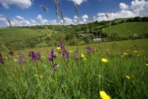
 The Wildlife Trusts describe a Nature Recovery Network (NRN) as a joined-up system of places (habitats) important for wild plants and animals, on land and at sea. It will provide the habitats that wildlife needs to feed, breed, sleep and move from place to place. Critically it will allow the natural world to adapt to change.
This network of habitats will also provide a range of other critical benefits such as carbon sequestration, flood control, clean water, healthy soils and recreational opportunities.
The Devon Nature Recovery Network will form part of a national Nature Recovery Network, a key commitment in the government’s 25 Year Environment Plan.
Why is it needed?
We have seen huge losses of wildlife across Devon. Our remaining habitats are largely disconnected from each other, often small and often in poor condition. Many are still at risk from impacts such as climate change, invasives and disease, nutrient enrichment and recreational disturbance. We all need to take urgent action to create, enhance, expand and connect wildlife habitats across the county – in our villages, towns, countryside and seas.
See Why we need the Devon NRN and national context for more information.
How will we achieve it?
It will be up to all of us (farmers, community groups, individuals, Local Authorities, developers, wildlife NGOs etc) to deliver the Nature Recovery Network. Some actions will be voluntary, some funded and some required by legislation. A toolkit of guidance and funding (including Environmental Land Management funds to farmers, Biodiversity Net Gain payments from developers, Carbon Offsetting funding for habitat creation and grants from HLF, Devon Environment Foundation etc) will align with priorities set out in the Devon Local Nature Recovery Strategy and Devon NRN Map.
Devon Local Nature Recovery Strategy
Under the 2021 Environment Act there is a requirement to produce a Devon Local Nature Recovery Strategy (LNRS). This will set out the priorities and actions required to achieve the Devon Nature Recovery Network. It will also include a map which will show existing habitats and highlight opportunities and priorities. This map is currently known as the Devon NRN Map, see below for more information. Work on the LNRS has already started. You can find out more information on our LNRS webpage.
Devon Nature Recovery Network (NRN) Map
Work has begun to produce a Devon NRN Map. This includes existing areas of wildlife rich habitats (Core Nature Areas and Nature Areas), habitat suitability (a map showing which habitats would occur naturally across our landscapes due to soils, geology and landscape) and priority areas for action (Strategic Nature Areas). The map currently includes inter-tidal areas. Other marine habitats will be included in the future.
The map can be used to help us all target conservation effort and prioritise funding.
To find out more, including a link to Phase 1 of the map, see our Devon NRN Map webpage.
Contacts
Devon NRN Map (project and technical lead): Ed Parr Ferris – eparrferris@devonwildlifetrust.org
Devon Local Nature Recovery Strategy and Chair of NRN Mapping Group: Sarah Jennings – Sarah.Jennings@devon.gov.uk
DCC Environment Viewer: naturalenvironment-mailbox@devon.gov.uk